CartoLegend · visual progress report
UPDATED 2026-08-04

Real maps. Real outputs.

Scanned maps → usable GIS data

A scan goes in. Point records, editable polygons and map coordinates come out.

87%targets found · 347 targets
8,734GIS polygons · 12 sheets
20example images
5measured charts
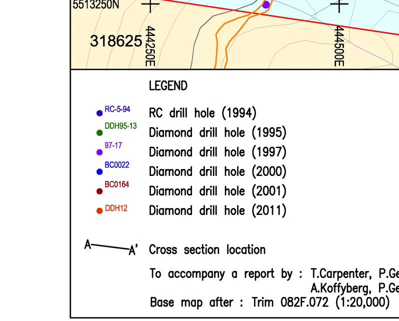
Raw Black Crystal geologic-map legend crop1 · scan
Point-symbol proposal row from the Black Canyon map2 · locate
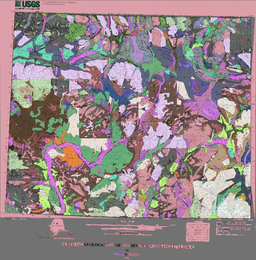
Hughes map body with extracted polygon regions3 · trace
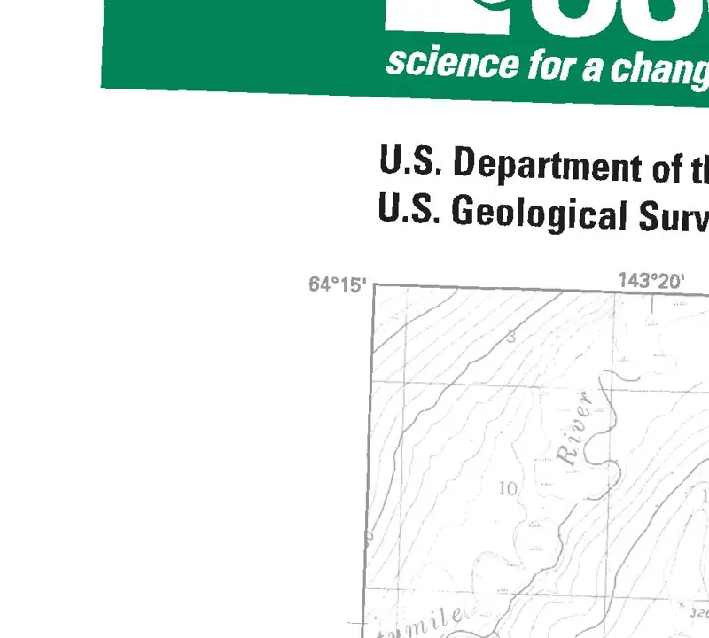
Latitude tick detected on the Kechumstuk map4 · place

Six real maps · input beside result

Pictures on the left. Saved data on the right.

Example 1 · Black Crystal

A printed dot becomes a data record

Six drill-hole entries were saved. Green marks the 2011 dot.

Black Crystal legend crop with the saved 2011 drill-hole box highlighted
INPUT + SAVED BOX · Black Crystal drill-hole legend.

Saved record · entry 6 of 6

labelDiamond drill hole (2011)
typepoint
box[194, 412, 205, 425]

Box center: 3.16 px from the reviewed center.

Example 2 · Black Canyon

A real miss, shown plainly

Three bedding symbols were printed. None matched.

Black Canyon legend row with one wrong saved box in red and three reviewed bedding symbols in green
RED · saved row. GREEN · Inclined, Overturned and Horizontal.

Saved record · only returned row

labelstrike
typepoint
box[10, 41, 86, 67]

CHECK · 0 of 3 matched. Inclined was mislabeled; two symbols were missed.

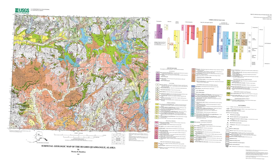
Example 3 · Hughes, Alaska

Map colors become editable polygons

Original scan on the left. Saved overlay on the right.

Original scanned Hughes geologic map sheet
INPUT · original public USGS scan.
Saved polygon overlay on the Hughes map
SAVED OVERLAY · bright = assigned; dark = unassigned.
50map-unit labels used
1,329editable shapes
41areas labeled al
1,217outline points for al
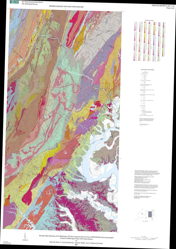
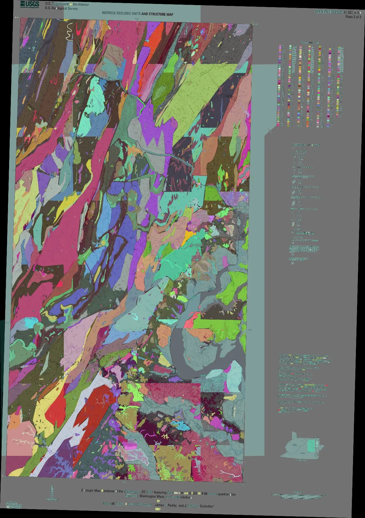
Example 4 · Frederick, Maryland

One scan becomes 1,042 GIS features

The right image is the saved overlay, not ground truth.

Public Frederick geologic map scan
INPUT · 10,250 × 14,537 source pixels.
Saved Frederick polygon overlay
SAVED OVERLAY · bright = assigned; dark = unassigned.
2,743polygon contours
267unit codes
48.78%map pixels assigned
1,042delivered map-unit features
Example 5 · Needles, California/Arizona

An evaluated success case

The score belongs to the exact overlay pictured below.

Public Needles geologic map scan
INPUT · 11,100 × 8,850 source pixels.
Evaluated Needles polygon overlay
SAVED OVERLAY · same-stage result used for the score.
716polygon contours
33 / 34unit codes present
78.63%map pixels assigned
66.08%pixel F1
Example 6 · Kechumstuk, Alaska

A printed tick becomes a map coordinate

The printed 64°15′ mark is saved as 64.25° N.

Raw Kechumstuk evidence crop showing the 64 degrees 15 minutes latitude tick
RAW EVIDENCE · printed 64°15′ border tick.
Printed64°15′
Saved64.25° N · 9 border marks
Whole sheet
63.997–64.257° N143.387–142.696° W

Two pictures for every RC

RC1 → RC8

Every picture is a real saved input or overlay. Red means rejected.

released / currentresearch / gaterejected
RC1

Read point symbols from a legend

prototype
WHATBlack Crystal: six drill-hole rows saved as JSON.
WHYSimple rows worked; changed layouts broke them.
FIRST PROOF · no safe headline score
Black Crystal raw legend crop
Black Crystal · raw legend crop.
Snow Shoe raw legend crop
Snow Shoe · a different, harder layout.
RC2

Recover rows missed on the full legend

packaged
WHATCrop a missed symbol row and try that row again.
WHY159 of 167 known rows were recovered.
159 / 167 rows recovered across six splits
Strawberry Butte point-symbol input row
INPUT · Strawberry Butte · symbol row.
Peach Springs point-symbol input row
INPUT · Peach Springs · symbol row.
RC3

Try maps from completely new sources

source test
WHATBettles and House Rock were outside the training sources.
WHYOnly 2 more of 106 target symbols were found.
BLIND-1 · 39 → 41 / 106 matches
Bettles new-source legend crop
INPUT · Bettles · new source layout.
House Rock new-source legend crop
INPUT · House Rock · second source layout.
RC4

Save each mark with its printed label

released
WHATLabel + point type + pixel box.
WHYReleased, with real successes and real misses.
BLIND-1 · 58/106 · P .563   |   BLIND-2 · 45/100 · P .584
Black Canyon point-symbol input crop
INPUT · Black Canyon · three printed bedding symbols.
Howard Pass point-symbol input crop
INPUT · Howard Pass · two printed deposit symbols.
RC5

New training made new-map results worse

5.1–5.3 rejected
WHATBlind-1 fell 58 → 50; Blind-2 fell 45 → 34.
WHYRejected. RC4 stayed public.
50/106 · 34/100 · 55/145   |   NOT SHIPPED
Crown Point RC5 blind point-symbol example
Crown Point · real blind point-symbol example.
Bartlett RC5 hard-negative swatch example
Bartlett · hard-negative swatch that helped reject RC5.
RC6

Clean fake sheets did not transfer

mixed result
WHATClean and degraded synthetic symbol sheets.
WHYThe synthetic version was rejected; RC4-Modern still improved.
RC4-MODERN · 52 → 77 / 167 · 0 empty-map false positives
Clean synthetic RC6 geology symbol sheet
Clean synthetic sheet · plausible training input.
Degraded synthetic RC6 geology symbol sheet
Degraded synthetic sheet · transfer still failed.
RC7

Trace whole-map colored regions

area tracing
WHATHughes: 1,329 editable shapes across 50 labels.
WHYWhole geologic regions could now open in GIS.
347 TARGETS · R .8415 · P .7087 · IoU .172
Hughes saved polygon overlay
OUTPUT · Hughes · every bright shape has an assigned label.
New Mexico Volcanoes saved polygon overlay
OUTPUT · Volcanoes · a different map layout.
RC8

Export polygons with labels and coordinates

GIS delivery
WHATFrederick: 1,042 features. Needles: 591.
WHY12 GeoJSON files + 12 matching GeoPackages.
R .8732 · P .7426 · IoU .421   |   8,734 polygons
Frederick saved map-unit overlay
OUTPUT · Frederick · saved map-unit shapes.
Kechumstuk printed latitude tick crop
INPUT · Kechumstuk · printed 64°15′ border mark.

Measured, not illustrated

Five charts

Counts stay attached to their own frozen test. Rejected work is red.

Point symbols found on new-source maps

Targets found; each bar shows its own denominator.

Blind-1 · 106 targets

RC239
RC341
RC458
RC550

Blind-2 · 100 targets

RC323
RC445
RC534

RC8 colored-region score

10 sheets · 347 target regions.

Recall87%
Precision74%
IoU42%

Same maps: RC7 vs RC8

Same 10 sheets and 347 targets.

Recall
Precision
IoU
RC7RC8

What each delivered polygon contains

8,734 polygons · 12 public sheets.

Codes100%
Names76.1%
Descriptions39.4%
Strict form31.2%

Same 99 labels read three times

Divergent units in three 5-pass blocks · 99 units.

Block A5
Block B7
Block C2
Union11
All three0

Read before comparing

Limits

Show the limits

RC4 bars use their named new-source tests. RC7/RC8 use 10 public maps and 347 target regions. A filled field can be wrong. Repeated answers can be wrong. Colored overlays are saved outputs, not ground truth.